Federal military authorities were keenly aware that they were unprepared to fight a war on American soil. Any significant campaign into the seceding states could be successfully carried out only after good maps, based on reliable data from the field, had been prepared. Existing Federal mapping units, such as the Army's Corps of Topographical Engineers and Corps of Engineers, the Treasury Department's Coast Survey, and the Navy's Hydrographic Office, therefore, were considered of immense importance to the war effort and were given full support to expand and carry out their missions. Although Federal authorities were unprepared to fight a war, they had one great advantage over the Confederacy: they were able to build upon an existing organizational structure, which included equipment and trained personnel.
Mapping of Washington, D.C.
As the war began, perhaps the most vulnerable area of the Union was the nation's capital. Situated on the banks of the Potomac River, Washington, D.C., was located between the Commonwealth of Virginia which ratified the ordinance of secession on April 17, 1861, and Maryland, which initially wavered, but remained a part of the Union. On the evening of May 23, as soon as sufficient troops were on hand in the nation's capital, Federal regiments crossed the Potomac into Virginia and began occupying the strategic approaches to the city. Within the next two months efforts were concentrated on the preparation of earthen fortifications to defend the city from an attack from the South. Throughout the war the defenses of Washington were extended, strengthened, and modified. Entrusted with this important task was Bvt. Maj. Gen. John G. Barnard of the Corps of Engineers. General Barnard served as Chief Engineer of the Army of the Potomac, 1861 to 1862, Chief Engineer of the Department of Washington from 1861 to 1864, and then as Chief Engineer of the armies in the field from 1864 to 1865. In his Report on the Defenses of Washington published after the war, Barnard noted with some pride that:
From a few isolated works covering bridges or commanding a few especially important points, was developed a connected system of fortification by which every prominent point, at intervals of 800 to 1,000 yards, was occupied by an inclosed field-fort every important approach or depression of ground, unseen from the forts, swept by a battery for field-guns, and the whole connected by rifle-trenches which were in fact lines of infantry parapet, furnishing emplacement for two ranks of men and affording covered communication along the line, while roads were opened wherever necessary, so that troops and artillery could be moved rapidly from one point of the immense periphery to another, or under cover, from point to point along the line.
Of the numerous maps depicting the defenses of Washington, D.C., the detailed map compiled by the U.S. Army Corps of Engineers showing the entire interlinking network of fortifications is of particular importance. Measuring 132 by 144 cm., this remarkable map was made to accompany General Barnard's official report on the defenses of the nation's capital. Albert Boschke's notable 1861 printed map of Washington, D.C., was used as the base, and to it army mapmakers added, by hand, cultural data on Virginia, a new map title, forts, batteries, and rifle pits, as well as the military roads built to link them (LC Civil War Maps no. 676).
Mapping of Northern Virginia
Occupancy of key positions in Virginia enabled Federal officials to begin the first major mapping project of the war. In June 1861, on orders from Winfield Scott, General in Chief of the Army, two field parties made up of U.S. Coast Survey personnel and under the direction of H.L. Whiting, the survey's "most experienced field assistant," began a 38-square-mile plane table survey of the secured part of northern Virginia. Transportation and protection were provided by army detachments, and the actual map itself was compiled in the Topographical Engineers Office at the Division Headquarters of Gen. Irvin McDowell at Arlington, Virginia. This cooperative undertaking involving both Coast Survey and army personnel was to be the pattern followed throughout the war. Coast Survey assistants provided valuable service to armies in the field as well as to the naval squadrons blockading Southern bays, harbors, and ports.
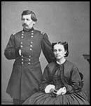
Detail of [Portrait of Maj. Gen. George B. McClellan, officer of the Federal Army, and his wife, Ellen Mary Marcy] |
Work on the map was interrupted in July when Federal troops in northern Virginia suffered a jolting defeat at Manassas, Virginia (Bull Run). The need for an accurate map of northern Virginia was reinforced by the Union disaster only a few miles from the capital city. Work was quickly resumed on this key map and, under orders from Gen. George McClellan, who had assumed command of the armies around Washington, the area covered by the survey was significantly expanded. The first edition of the map was "engraved on stone" and issued on January 1, 1862.
A second edition incorporating corrections "from recent surveys and reconnaissances under direction of the Bureau of Topographical Engineers" was published on August 1, 1862, only 28 days before the second Battle of Manassas, Virginia.
Published at the scale of one inch to one mile (1:63,360), field assistant Whiting commented that "The detailed survey shows all the important topographical features of the country which it embraces; the main roads, by-roads, and bridle-paths; the woods, open grounds, and streams; houses, out-buildings, and fences; with as close a sketch of contour as the hidden character of the country would allow--producing in all a map by which any practicable military movement might be studied and planned with perfect reliability." This was the first detailed map of northern Virginia to be compiled and published, and it remains today an essential cartographic tool for the study of that region at mid-nineteenth century (LC Civil War Maps nos. 466-470).
Field Reconnaissance
Federal authorities used every means at their disposal to gather accurate information on the location, number, movement, and intent of Confederate armed forces. Army cavalry parties were constantly probing the countryside in search of the enemy's picket lines; travelers and peddlers were interrogated; Southerners sympathetic to the Union were contacted and questioned; and spies were dispatched into the interior to obtain information. The army also turned to a new device for gathering information, the stationary observation balloon. Early in the war a balloon corps under the direction of Thaddeus Lowe was established and attached to the Army of the Potomac. Although used chiefly for observing the enemy's position in the field, the balloon was also successfully employed for the making of maps and sketches. Aeronaut John La Montain made one of the earliest sketches from the platform of a balloon. Dated August 10, 1861, the simple sketch shows the location of Confederate tents and batteries at Sewall's Point, Virginia (LC Civil War Maps no. 654).