
, MA - 1844, image 1, World Maps Online")
Historic Map - North Bridgewater (now Brockton), MA - 1844
Description
View of North Bridgewater, Plymouth County, M.A., 1844 / drawn & published by A. F. Poole.
This panoramic print of North Bridgewater or Brockton, as it is called today, was drawn by A. F. Poole and published by Beck & Pauli, lithographers in 1844. Brockton was established by Europeans in the early 1700's. Then known as North Bridgewater, the community now called Brockton, was a small town in the 1840's that served the many farmers of the area.
Indian corn, rye, barley, oats, hay and potatoes were grown abundantly, as well as apples and pears. Livestock were raised throughout the region, and much production of milk, butter and cheese was carried out in Brockton.
The illustration of North Bridgewater shows buildings, road and stone walls.
Features references to the following locations:
- First Church.
- New Jerusalem Church.
- Old Academy.
- Post Office.
- Hotel.
Materials
Archival Paper

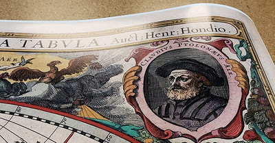
Premium fine art paper that provides accurate color reproduction with high-contrast, high-resolution print output and maximum image permanence. A high-quality print ready for framing.
More
- Museum quality paper for high-quality fine art.
- Ultra smooth, neutral white matte finish.
- Heavy-weight 230 gsm, 9.5 mil thickness.
- Printed with pigment inks for longer print life and enhanced fade resistance.
- Pigment based Canon LUCIA inks provide smooth tones and rich colors in fine, precise detail.
Luster Photo Paper
A premium semi-gloss photo paper with a subtle texture that produces a vivid, richly detailed print. This material results in an exquisitely detailed giclee print of substantially higher quality than a standard poster.
More
- Printed on 10 mil premium luster photo paper resulting in a brilliant, colorful image with a vivid life-like quality.
- Pigment based Canon LUCIA inks provide smooth tones and rich colors in fine, precise detail.
- Inks have a lightfastness rating of over 100 years, guaranteeing minimal noticeable fading over a very long period of time.
- Printed using very high resolution source files.
- Giclee printing is superior to traditional lithography in a number of ways: colors are brighter, lasts longer, and is a higher resolution.
Canvas on Wood Rails
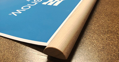
A canvas giclee print is mounted to wooden hanging rails placed along the top and bottom of the map. Ready to hang on the wall using the attached hanging cord. Wood rails feature a natural finish.
More
- Premium 19 mil canvas material.
- Wood rails are 1 1/8" wide, round front.
- USA sourced solid maple wood.
- High quality giclee fine art print with a lightfastness rating of over 100 years.
- Pigment based Canon LUCIA inks provide smooth tones and rich colors in fine, precise detail.
Canvas Gallery Wrap
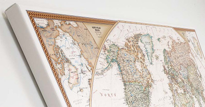
A high quality canvas giclee print is hand stretched over a sturdy wood frame. Printed on demand and handcrafted in Seattle, WA. The canvas gallery wrap serves as a stunning piece of art ready to hang on your wall.
More
- Premium 19 mil canvas material.
- Pigment based Canon LUCIA inks provide smooth tones and rich colors in fine, precise detail.
- High quality giclee fine art print with a lightfastness rating of over 100 years.
- Durable canvas mounted to a 1" deep wood frame.
- Ready to hang with included easy-to-use hanging kit.
Framed Map Print - Black Finish
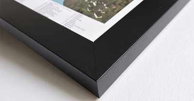
Our gallery quality frames are made of solid wood and feature optical-grade acrylic. Each framed map is printed on premium archival matte fine art paper.
More
- Printed on thick, luxurious acid-free fine art paper & dry-mounted to foam board.
- Pigment inks ensure a vivid print with amazing colors and excellent fade resistance.
- Solid wood frame with a black finish has a 1.25" face & 7/8" depth.
- Kraft paper protective backing & hanging wire installed.
Framed Map Print - Natural Oak Finish
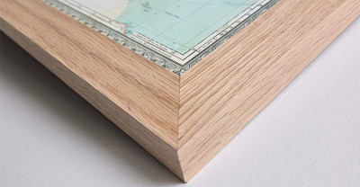
Our gallery quality frames are made of solid wood and feature optical-grade acrylic. Each framed map is printed on premium archival matte fine art paper.
More
- Printed on thick, luxurious acid-free fine art paper & dry-mounted to foam board.
- Pigment inks ensure a vivid print with amazing colors and excellent fade resistance.
- Solid wood frame with a natural oak finish has a 1.25" face & 7/8" depth.
- Kraft paper protective backing & hanging wire installed.


