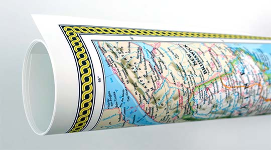
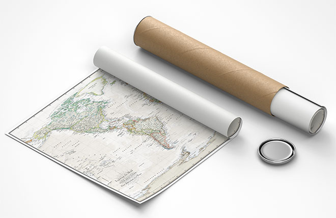
Bird's eye view of the city of Portage, Columbia Co., Wisconsin 1868. Drawn by A. Ruger.
Historic panoramic view map of Portage, Wisconsin, drawn by Albert Ruger in 1868, reprint. Named for the natural portage that its lowland position offered between the Fox and the Wisconsin Rivers, the community developed as a trade and commerce center quite naturally. American settlement began in the early 1820s. Fort Winnebago was built in 1828 and the end of the Blackhawk War allowed a flood of European immigration to settle in Wisconsin, in which Portage City played an important role as a transportation hub. The railroad arrived in 1857.
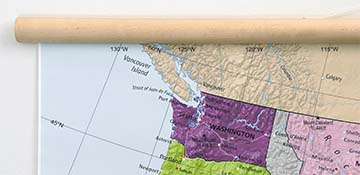
This map captures the town as it appeared eight years before the completion of the Portage Canal.
Inset illustrations of the Public School and Courthouse are featured in the lower margin of the historic map.
Features numbered references to the following locations:
- Court House.
- Public School.
- Milwaukee & St. Paul Railroad Depot.
- County Jail.
- Fort Winnebago.
- Presbyterian Church.
- Episcopal Church.
- Methodist Church.
- Lutheran Church.
- Catholic Church.
- Baptist Church.
- Fox House.
- Ellsworth House.
- City Hotel.
- Portage Hotel.
- Commercial College.
Following is a lecture recalling the early days of Fort Winnebago as well as a personal account of the Black Hawk War, given by the Honorable Satterlee Clark, a former Wisconsin senator and attorney who was one of the early settlers in the Portage area. The lecture was delivered at the court house in Portage and ran in several local newspapers. He delivered the speech on March 21, 1879.
"At a request of a number of citizens of this city, I have been invited to address you upon the early history of Fort Winnebago and its surroundings. To give you a thorough understanding of the history, (not only of the Fort, but the persons intimately connected therewith) it will be necessary to detail to you my early recollections, from my arrival in what is now the state of Wisconsin. On the 14th day of April 1823 I landed at Green Bay, then considered a small French settlement. Fort Howard was then situated near where the passenger depot of the C. & N. W. railroad now stands. On the opposite side of the river where the city of Green Bay is located there was a wilderness. Nine miles above on the river, was a small group of houses that hardly could be termed a village, but which was nevertheless called "Shanty Town". Residing there were several American families, among whom were Dan'l Whitney, Henry S. Baird, Rob. Irwin, Alex. Irwin, Sam'l Irwin and quite a number of French and half breeds. The Fort contained three companies of U. S. Infantry and was commanded by then Maj. Twiggs, afterwards General. The companies were severally commanded by Capt. and his brother Maj. Buell, Capt. Spence and Capt., now Gen. Wm Harney.
GENERAL HARNEY AND JEFF DAVIS
Of the officers stationed at Fort Winnebago from 1828 till the 5th of July 1831, only two survive, to-wit: Gen. Wm Harney and Jeff Davis. Harney at that time was a Captain, and Davis was his subaltern. Both were considered among the best officers in the service. I think it is conceded that for frontier service Capt. Harney had no superior anywhere. There was no better disciplinarian, and no more indulgent officer to his men when their behavior was good. It has been said of him (by persons in civil live) that he was cruel to his men, but this is not true. He was, however, a terror to evil doers, whether soldier or citizens. To give you an idea of the man, he was over six feet in height, well proportioned, and exceedingly active and strong. I think you would be interested while I relate an anecdote or two which will give you a more correct idea of his character.
Gen. Harney once took offence at an Indian, and determined to cowhide him, but was persuaded to give him "a chance for his life". He had him taken half a mile above the government wash houses on the bank of the river, gave him 100 yards start with the agreement that if the Indian passed the wash houses before he was caught, he should go free for that time. Pierre Pauguette gave the word, and away they went. Harney gaining on him so rapidly that he seemed sure to overtake him. There was a spot about 200 yards from the wash house that only froze over in very cold weather and opened again during the day. The night before was very cold, and this point had frozen over about half an inch thick. When they reached this point Harney was just ready to put his hand on him, when the Indian being quite light crossed the thin ice safely. Not so, however, with the captain; he carried too many pounds and down he went. he came to the surface at once and called to a sentinel to shoot the Indian. The sentinel fired well and the ball struck the ice half a mile from the Indian. All the officers were on the bank witnessing the race and of course were convulsed with laughter.
On another occasion it was necessary to punish the champion pugilist of the fort, a very large man named Hewitt. The man said to the captain, "if you were an enlisted man, or I was a captain, you could not treat me in that way". Harney took him out behind the barracks, told him to consider himself a captain, and do his best. Hewitt pitched at the captain furiously, when the captain knocked him down. this was repeated about a dozen times, when he said, "captain, I have been a captain long enough to suit me, I would now like to be reduced to the ranks".
WITH PIERRE PAUQUETTE
His strength was so immeasurable, and his exploits so astonishing, that while relating what I have seen I shall tell only the exact truth, I will promise not to be offended if some of you should be a little skeptical.
Pierre Pauquette was born in the year 1800 of a French man and a Winnebago squaw. His mother was buried nearly in front of the Old Agency house opposite the fort. He was 30 years old when I first knew of him and was the very best specimen of a man I ever saw. He was six feet two inches in height, and weighed two hundred and forty pounds, hardly ever varying one pound. He was a very handsome man, was hospitable generous and kind, and I think I never saw a better natured man.
I had heard much of his strength before I left Green Bay and, of course, was anxious to see him perform some of the wonderful feats of strength of which I had heard. From my first acquaintance with him to the day of his death I was his most intimate friend, and consequently had a better opportunity to know him than any other person. I will now endeavor to give you an idea of his strength and activity, which to me seemed almost superhuman. He often told me that all persons seemed alike to him. When I was 19 or 20 years old my business kept me constantly in training, and though I weighed less than 150 pounds, my muscles were like iron, notwithstanding he often said it was no more trouble to take me across his lap than a child one year old, and so it seemed to me. I was told that on one occasion when he was making the Portage with a heavy boat one of his oxen gave out, and he took the yoke off and carried the end against an ox all the way over. I did not see this, but I asked him if it was so and he replied it was.
I once saw him take hold of the staple to a pile driver weighing 1650 lbs. and lift it apparently without any exertion and swing it back and forth for a minute of time.
I have several times seen him get under a common sized horse, put his arms round the hind legs, his back under the horse's stomach and lift the horse clean off the ground. Many other things I have seem him do which would tire your patience were I to relate them.
You can readily imagine, however, that scarcely anything could be impossible to such a man.
He was employed by the American Fur company up to the day of his death.
PAUQUETTE'S DEATH
The council closed on the 17th day of October, 1836, and the next day Pauguette came to my store to rejoice over our victory.
On this occasion he drank too much wine and became just enough intoxicated to be impatient of contradiction. In this condition he started home on foot, and when within about one quarter of a mile of the ferry opposite his house, he found an Indian and his wife sitting by a little fire in the bushes. The Indian was Mah-zah-mah-nee-kah, or Iron Walker, who was also drunk. What occurred then all depends upon the squaw as given that night. She says Pauquette kicked the fire apart, the Indian arose and said something that offended Pauquette, who slapped the Indian's face knocking him down. The Indian got up saying, "You knocked me down, but I got up. I will knock you down, and you will never get up. I will go for my gun." Pauquette only laughed and sat down. The Indian returned, when Pauquette stood up, pulled open his coat, placed his hand on his breast said, "Strike and see a brave man die". The Indian fired killing him instantly, the ball severing one of the main arteries leading from the heart. Nor man in Wisconsin could have died who was so much regretted.
His death can safely be attributed to intoxication, though it was the first time I ever knew or heard of his being in that condition.
There has been some doubt as to where Pauquette was buried, and I will state what I know of his burial. In the first instance, while he did not claim to belong to any religious denomination, his wife being a Catholic he built a small church near the centre of this city.
At his death I assisted to bury his remains under the floor of his church. Subsequently the church was burned, and still later while I was living at Green Lake I received a summons to come up and point out his grave, some of his friends being desirous to remove his body. I came up and found the locality without any difficulty, but never heard whether he was removed, or if so where to.
THE BLACK HAWK WAR
The most interesting event since my advent into Wisconsin was what is known as "Black Hawk War", the truthful history of which has never been published, and I think the causes that led to it, and the incidents connected therewith, are known to very few people now living.
In 1831, in violation of a treaty stipulation, the Sacs and Fox Indians under Black Hawk and the Prophet crossed the Mississippi into Illinois. Black Hawk was a Fox Indian, and the Prophet was a Winnebago, who, with a small band, became discontented and left the Winnebagoes and joined the Sacs and Fox tribes, where they had inter-married, and became part of the same tribe.
Gen. Atkinson was ordered to remove them. They offered to go back and remain for 60,000 bushels of corn, and as corn was only 5 cents a bushel, he gave it to them and they retired.
The following summer, thinking to get 60,000 bushels of corn quite as easily they again crossed the river, and again Gen. Atkinson was ordered to remove them.
Instead of buying corn for them he ordered all the available troops into the field, and the President ordered out the Illinois militia under the command of Gen. Henry and Gen. Alexander, all under the command of Gen. Atkinson.
The Indians started up Rock river, pursued by the troops, committing occasional depredations as they went along.
After they got into Wisconsin the troops lost track of the, and Gen. Atkinson continued up the Rock river to where the village of Fort Atkinson now stands, where he established his headquarters and built a temporary fort. In the meantime Black Hawk, learning from the Winnegbagoes who also promised to assist him, that only thirty men remained in Fort Winnebago, determined to burn it and massacre its inmates.
They accordingly came and encamped on the Fox river about four miles above Swan Lake and about eight miles from the fort. Every possible means that could be devised was adopted to protect the fort and save the lives of the inhabitants, most of whom were women and children; but after all had been done that was possible, the commanding officer concluded that without re0enforcements we would be lost, and determined to send to Gen. Atkinson for troops.
I WAS ACCORDINGLY SELECTED
for that duty for several reasons; among which was my thorough acquaintance with the country, and another was the probability that the Winnebagoes would not harm me.
Every day some Winnebago would come to me and advise me to go at night and stay in his wigwam where he said I would be safe.
At nine o'clock at night I left the fort with many a God speed you, armed with a small Ruggles rifle, my dispatches, a tomahawk and bowie knife. I crossed the Fox river at a shallow point just above where the public stables used to stand, and keeping the Indian trail that led from here to White Crows' village on Lake Kosh-Konong on my right, I traveled rapidly all night, walking up hill and running down hill and on a level. I struck the trail several times during the night, but left immediately as I feared some Indians might be encamped upon it, whose dogs would discover me before I would discover them.
I arrived safely at the fort at half past 11 o'clock in the forenoon, and delivered by dispatches to Gen. Atkinson, who sent 3,000 men at once to relieve Fort Winnebago.
I slept till 4 o'clock in the afternoon, and then started on my return following the trail of the mounted militia for twelve miles, when I passed them, and reached the head of a stream that used to be called Rowans creek, about twelve miles from the fort shortly after daylight, and fearing to go further till night, I crawled into some brush and went to sleep.
As soon as it was quite dark I left my hiding place and returned to the fort as near as possible by the route I left it, arriving between ten and eleven o'clock p.m.. I reported that the troops were on the way and would arrive next evening. We kept close watch all that night, and at four o'clock p.m. next day...
THE TROOPS ARRIVED
Some of you may be surprised that I should travel so rapidly and the mounted troops should be so long on the road; but you must recollect the marshes were very wet at that time, that the whole country was a wilderness, and that when I jumped into a stream and waded through or walked across the marsh, the troops had to build bridges and causeways.
The war would have been ended within two days if the militia had been in condition to follow the Indians, but the horses needed rest and food, rations had to be issued to the men, and many of them were without a change of underclothing, and it was absolutely necessary to wait at least one day at the fort.
A STAMPEDE
The second night the horses took fright (probably at some Winnebago Indians) and there was a regular stampede. Probably some of my hearers may not thoroughly comprehend a stampede, and it may be proper to describe it, if possible, though only an eye witness can properly appreciate how terrible it is. Some horse or maybe a few horses get frightened and start to run, the entire drove may see nothing to alarm them but presume there is danger, and they fall into line, and once fairly under way nothing can stop them.
Those in front cannot stop without being run over, and those in the rear run to keep up. On this occasion about sixteen hundred horses started with a noise like thunder, running so close together that when one is so unfortunate as to face a tree he was either killed or so badly injured as to be unable to proceed, and was run over by the whole drove; so if a horse was unable to keep up he was knocked down and killed; between the bank of the Wisconsin and the point of land between there and the fort thirty-seven horses were found dead.
They took the trail they came on, and ran to the prairie, a distance of about sixteen miles, over sixty horses were killed and it was late next day before they were brought back. This of course occasioned another delay and it was not till the fifth day, that the left the fort in
PURSUIT OF THE INDIANS.
The Indians in the meantime went to the Four Lakes where as I learned later, they were advised to cross the Wisconsin and the Mississippi as soon as possible. A few reliable Winnebagoes under Pierre Pauquette and myself were secured for scouts. We had no difficulty in following their trail and gained upon them rapidly, overtaking them on the bank of the Wisconsin about twenty-five miles below here where the battle of Wisconsin was fought. That battle
MADE MANY HEROES,
and so it should.
About one hundred and twenty half-breed Indians defended the pass against nearly three thousand whites, while the remainder of the Indians in plain sight were crossing the Wisconsin with the women and children and as soon as the women and children were safe, the Indians broke and ran. Then came the struggle for scalps. Every man who could run started down the hill at his top speed, my Indian scouts and myself far ahead of the militia, and I was about thirty feet ahead of all. Just as I commenced rising the hill on the other side of the valley, Pauquette passed me on horseback, and as he went by I caught his horse by the tail and held on the the top of the hill, where we found four dead Indians; Pauquette took one scalp.
I TOOK ONE,
and the Indian scouts took the other tow.
The Indians lost four killed all told, and the whites one. This ended the battle of the Wisconsin about which so much has been written.
The Indians traveled as rapidly as possible to the Mississippi near the mouth of the Bad Axe river. I went home. Shortly after Capt. Alexander Johnson was ordered to take command of the regular troops and endeavor to intercept the Indians and prevent their crossing the Mississippi.
A steamboat was sent up the river from Fort Crawford commanded by Jeff Davis. He drove the Indians back and they were all killed or taken prisoners except Black Hawk and the Prophet and their families, who crossed the river before the steamboat arrived. Gen. Winfield Scott offered a reward of $2,000 for the capture of Black Hawk and the Prophet, which was earned by a Winnebago called Little Thunder. All were then taken to Rock Island, where Gen. Scott had established his headquarters.
From there the leaders were taken to all the large cities in the country, to show them how impossible it was for them to wage successful war against the Whites.
That ended the Black Hawk War."
-Satterlee Clark.