California
Historical Maps of California
Panoramic maps of American cities and towns, often called bird’s-eye views or perspective maps, offer a glimpse into the life of a town or city that is “frozen-in-time”, capturing the town as it appeared from an elevated perspective, and often listing prominent businesses and residents. Spanning most of the 19th century, cartographic artists such as Thaddeus Mortimer Fowler, Oakley H. Bailey and Albert Ruger provided maps that served to promote a city’s commercial and residential potential, often featuring architectural renderings of public and commercial establishments, as well as private homes. These maps stand as a testament to American ambition and hope as a newly created nation faced their bright future.
We are constantly working to expand our collection of historic maps. Please revisit often to see what’s new.
-

Historic Map - Los Angeles, CA - 1909
Starting at $45.00 -

Historic Map - Healdsburg, CA - 1876
Starting at $50.00 -

Historical Map of San Francisco, CA - 1868
Starting at $45.00 -

Historical Map of Santa Barbara, CA - 1896
Starting at $50.00 -

Historical Map of Santa Barbara, CA - 1898
Starting at $50.00 -

Historical Map of Stockton, CA - 1895
Starting at $45.00 -

Historical Map of Azusa, CA - 1887
Starting at $50.00 -

Historical Map of Yreka, CA - 1884
Starting at $50.00 -

Historic Map - Stockton, CA - 1895 - John H. Mitchell
Starting at $50.00 -

Historic Map - Los Angeles, CA - 1877 - A.L. Bancroft & Co.
Starting at $45.00 -

Historic Map - Sacramento, CA - 1850 - Geo. W. Casilear & Henry Bainbridge
Starting at $45.00 -

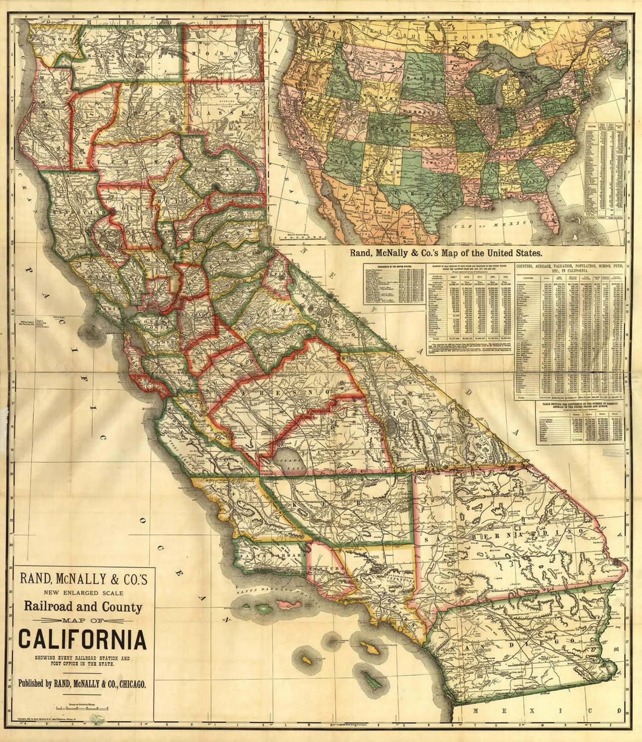
Historic Map - California - Railroad & Counties - 1883
Starting at $50.00 -

Historic Map - Stockton, CA - 1895
Starting at $45.00 -

Historic Map - California State - Roads for Cyclers - 1895
Starting at $50.00 -

Historic Map - Los Angeles, CA - 1894
Starting at $45.00 -

Historic Map - Los Angeles, CA - 1891
Starting at $50.00 -

Historic Map - Sacramento, CA - 1890
Starting at $45.00 -

Historic Map - Auburn, CA - 1887
Starting at $50.00 -

Historic Map - Los Angeles, Cal. - 1888
Starting at $45.00 -

Historic Map - California State Map - 1888
Starting at $50.00 -

Historic Map - San Francisco, CA - 1878
Starting at $50.00 -

Historic Map - Santa Barbara, CA - 1877
Starting at $45.00 -

Historic Map - Los Angeles, CA - 1877
Starting at $45.00 -

Historic Map - San Jose, CA - 1869
Starting at $45.00 -

Historic Map - San Francisco, CA - 1864
Starting at $50.00 -

Historic Map - San Francisco, CA - 1860
Starting at $50.00 -

Historic Map - San Francisco, CA - 1855
Starting at $45.00 -

Historic Map - California - Mining District - 1851
Starting at $50.00 -

Historic Map - California - Gold Region - 1851
Starting at $50.00 -

Historic Map - San Francisco, CA - 1851
Starting at $50.00 -

Historic Map - Sacramento, CA - 1850
Starting at $50.00 -

Historic Map - San Francisco, CA - 1846
Starting at $50.00 -

Historic Map - Coronado Beach - San Diego, CA - 1880's
Starting at $50.00 -

Historic Railroad Map of Nevada & California - 1874
Starting at $50.00 -

Historic Map - Los Angeles, CA - 1909 - Black & White
Starting at $45.00 -

Historic Map - Berkeley, CA - 1909
Starting at $45.00 -

Historic Map - San Pedro, CA - 1905
Starting at $45.00 -

Historic Map - Pasadena, CA - 1903
Starting at $45.00 -

Historic Map - Eureka, CA - 1902
Starting at $50.00 -

Historic Map - San Jose, CA - 1901
Starting at $45.00 -

Historic Map - Fresno, CA - 1901
Starting at $45.00 -

Historic Map - Bakersfield, CA - 1901
Starting at $45.00 -

Historic Map - Oakland, CA - 1900
Starting at $45.00 -

Los Angeles 1877 Birds-Eye View w/ Blue Water Wall Map
Starting at $45.00 -

Historic Map - Beverly Hills, CA - Movie Guide - 1938
Starting at $50.00 -

Historic Map - Hollywood, CA - Starland - 1937
Starting at $50.00 -

Historical Map - Los Angeles, California - 1934, from Bullock's Tea Room
Starting at $45.00 -

Historic Map - Los Angeles, CA - 1932
Starting at $45.00 -

Historic Map - Los Angeles, CA - 1929
Starting at $50.00
