Expanding Horizons European exploration in the 15th and 16th centuries drew on many sources. A growing desire for expansion and trade, along with advances in shipbuilding and commercial technique, fostered the search for new markets and for the legendary sources of precious metals and other commodities.
Portuguese exploration and trade along the West African coast and to Atlantic islands, encouraged and directed by Prince Henry de Avis, the Navigator, continued throughout the 15th century. He assembled an international team of experts which made revolutionary advances in geography, navigation, and cartography.
Handbooks, guides, and charts, along with the invention of more sophisticated and practical nautical instruments, professional-ized what had been largely an intuitive craft. Crucial to these innovations were Muslim and Jewish contributions in mapmaking and navigational instruments. Christopher Columbus went to sea on the crest of these maritime advances.
European World View: Imagined and Observed
European world view in the late 15th century wavered between bizarre imaginings about the unknown and scientific observations of the known. T-O maps illustrate a Medieval world view laid out into three continents by a T within a circle, but also record real and imagined countries.
Theories of the universe first proposed by ancient Greek or Roman philosophers were accepted well into the 16th century. For example, the Vopel globe was based on Ptolemy's idea of an earth-centered universe. Ironically, it was made in 1543, the same year that Nicolaus Copernicus published his heliocentric, or sun-centered, theory of the universe. Caspar Vopel was a master-craftsman of astronomical and navigational tools. He made the sphere encircling the globe so that the seasonal changes in the orbits of the heavenly bodies could be observed. His "nocturnal," or compendium, was used for telling time at night and had several other navigational functions.
 Terrestrial Globe with Armillary Sphere - Vopel, 1543.
Terrestrial and celestial globes and armillary spheres were important educational tools for illustrating the geographical, astronomical, and cosmographical concepts of the Renaissance and the Age of European Discovery. Terrestrial globes both reflected the spherical nature of the earth and served to document man's changing perception and expanding knowledge of the geography of the earth. Armillary spheres were demonstration models for teaching astronomy and for illustrating the earth's position within the universe.
This finely crafted and well-preserved three-inch terrestrial globe, within a six-inch armillary sphere, mounted on an octagonal brass base, is the work of Caspar Vopel (1511-1561), a teacher of mathematics in Cologne, Germany, and a scholar of wide cosmographical interests. Vopel skillfully drew by hand his portrayal of the earth's surface directly on the globe ball. Of particular historical interest is his portrayal of the uncertainty still prevalent in the first half of the sixteenth century among cosmographers regarding Columbus's contention that he had reached Asia. As shown on the globe, Vopel agreed with the school of thought that North America and Asia were joined as one landmass -- a misconception that continued on some maps until the late sixteenth century.
Vopel's armillary sphere presents a model of the Ptolemaic, or earth-centered, cosmic system. The series of eleven interlocking and overlapping brass rings or armilla, some of which are movable, that make up the armillary sphere are adjustable for the seasons and illustrate the circles of the sun, moon, known planets, and important stars. The wide ecliptic band includes delicate engravings of the signs of the zodiac. It is interesting to note that 1543 is not only the year of the construction of Vopel's armillary sphere, but it is also the year Copernicus's theory of a heliocentric universe was published, a theory that greatly changed the design of armillary spheres.
-
 Venetian Sailing DirectionsIn Stolfo, 1499.
By the late fifteenth century an emerging body of literature to facilitate sea travel in the Mediterranean world was available. This early book of sailing directions served as a handy guide for the sailor and a storehouse of practical information for laymen. The use of the hand and zodiac for information was considered vital to the 15th century Mediterranean navigator.
-
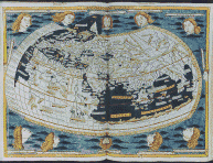 World Map In Germanus, 1482.
The most poular geographical work to be printed from movable type in the fifteenth century was Ptolemy's Geography or Cosmography. Originally compiled by the Alexandrian geographer, astronomer, and mathematician Claudius Ptolemy in the second century A.D., it was translated from Greek into Latin in Florence, Italy about 1410. The map of the world here reproduced, beautifully illuminated with twelve wind heads, is one of thirty-two maps illustrating the edition of the Cosmographia issued from the press of Lienhart Holle of Ulm, Germany, on July 6, 1482. Holle's edition was the first to be printed north of the Alps and the first to include maps printed from woodcuts. To produce his printed editin, Holle used a manuscript copy prepared under the direction of the Benedictine Monk known as Donnus Nicolaus Germanus.
This world map shows the state of European cartographic knowledge of the world prior to Columbus' 1492 voyage. It reflects the Ptolemaic world view. The old (or known) inhabited world oikoumene is depicted as extending 180 degrees east and west, but in reality it covers only 105 degrees of longitude. This elongation, greatly shortening the unknown portion of the earth, was to influence navigators such as Christopher Columbus for many years. Also depicted is Ptolemy's mistaken notion that the Indian Ocean was an enclosed body of water, an idea that was to be disproved only five years later by the successful rounding of the Cape of Good Hope by Bartholomeu Dias of Portugal.
New information began to find its way into the classical representations then in circulation in Western Europe, and the 1482 world map was no exception. Nicolaus Germanus, for example, extended the map northward to show Iceland (correctly positioned north of the British Isles) and Greenland (incorrectly shown as a peninsula of Europe). Raleigh Skelton in the introduction to the facsimile edition of Claudius Ptolemaeus Cosmographis, Ulm, 1482 (Amsterdam, 1963) noted that this is the "earliest printed delineation of Greenland, Iceland and the North Atlantic [on a world map]; and this was to exercise a potent influence in the cartography of the early 16th century."
-
![American Geographical Series In Waldseemuller [Ptolemaeus], 1513.](https://cdn11.bigcommerce.com/s-5luen2shhj/content/sm.geograph.gif) American Geographical Series In Waldseemuller [Ptolemaeus], 1513.
American Geographical Series In Waldseemuller [Ptolemaeus], 1513.The first appearance of a map of America in a Ptolemy atlas occurred in the 1513 Strasbourg edition, which included a series of new maps, based on findings from recent European explorations. Martin Waldseemuller of St. Die began work on this new edition of Ptolemy about 1505 and compiled the maps. In this work, America remains named Terra Incognita and Columbus is credited with informing Fernando and Isabel of its existence.
Library of Congress Collection
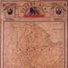 This large manuscript map of the Kingdom of Ethiopia once hung in the palace of His Royal Highness Ras Tafari, later known as Emperor Haile Selassie I. Presented to the Library in 1924 by Homer L. Shantz, who received it personally from Ras Tafari along with "some spears, shields, and coins" while on an official U.S. mission to map African vegetation, it was prepared by the court geographer in Addis Ababa "by order of the Regent" in 1923. His Imperial Majesty was reunited with the map when he viewed it during a visit to the Library of Congress on May 28, 1954, and recalled its presentation to Dr. Shantz thirty years earlier.
A number of individual rare maps and collections are noteworthy for their association with presidents of the United States, several of whom began their careers as surveyors or displayed some skill as cartographers, such as George Washington, Thomas Jefferson, and Millard Fillmore. The collections of two twentieth-century presidents, Theodore Roosevelt and Woodrow Wilson, reflect the expanding role of the presidency on the international scene. Other presidents associated with maps in the special collections include John Quincy Adams, James Buchanan, Abraham Lincoln, William McKinley, James Monroe, and Franklin Roosevelt.
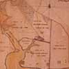 George Washington, who was trained as a surveyor when he was a teenager, prepared this manuscript plat in 1766 of lands that he had purchased adjacent to his ancestral plantation of Mount Vernon. Known as River Farm, this was one of five farms which comprised the 8,000 acres that he owned in the vicinity of Little Hunting Creek, less than ten miles south of Alexandria, Virginia.
One of the great treasures of the division is associated with the first and third presidents. Pierre Charles L'Enfant's original plan for the capital of the United States was compiled under the direction of Washington and extensively annotated by Jefferson. Submitted to President Washington on August 26, 1791, this event was commemorated by the Library two centuries later, on August 26, 1992, with the publication of a full-color facsimile reproduction and a newly created computer-generated (digitized) version of the plan. Entitled Plan of the City Intended for the Permanent Seat of the Government of the Untied States L'Enfant's plan forms the cornerstone of the Library's unrivalled collection of maps and atlases of the city of Washington, D.C. A study of the plan by Richard W. Stephenson is available under the title "A Plan Whol[l]y New": Pierre Charles L'Enfant's Plan of the City of Washington (Washington, 1993).
The geographic coverage of the division's special collections is worldwide but its primary focus is North and South America, with the strongest holdings in the general subjects of discovery and exploration, settlement, and military campaigns. General descriptions of the Library's holdings relating to the European discovery and exploration of America are found in two recent publications prepared in conjunction with the Library of Congress's Quincentenary Program: Louis De Vorsey, Jr., Keys to the Encounter: A Library of Congress Resource Guide for the Study of the Age of Discovery (Washington, 1992) and John R. Hbert (editor), 1492: An Ongoing Voyage (Washington, 1992). Both are well illustrated.
The division holds a small but representative collection of thirty-three portolan charts dating from the midfourteenth century to 1770. Portolan charts appear to have evolved from sailing guides, known as portolanos, during the late thirteenth century in northern Italy or in the western Mediterranean in the vicinity of Majorca or Barcelona. Hand-drawn on animal skins of parchment or vellum without borders and generally lacking titles and legends, they are characterized by a profusion of place names lettered perpendicular to the coastlines and an intersecting system of radiating lines and compass roses. Many are brightly illuminated and elaborately embellished. Among the most distinctive are an anonymous Catalan chart of the Mediterranean Sea dated before 1350 (the earliest portolan chart in the Western Hemisphere); and Samuel de Champlain's chart of his three-year exploration of the northeast coast of North America, which he drew on vellum during the winter of 1606 to 1607. The division's collection is described in Nautical Charts on Vellum in the Library of Congress (Washington, 1977), compiled by Walter W. Ristow and Raleigh A. Skelton.
The Library's holdings of sixteenth-century maps published during the Age of Discovery were enriched by one of its great benefactors in 1949 when Lessing J. Rosenwald donated six rare Renaissance maps including Diego Gutirrez's celebrated map of the Western Hemisphere entitled Americae sive qvartae orbis partis nova et exactissima descriptio (1562) The other gifts include Andr Thevet's equally rareLe Novveav monde descovvert et illvstre de nostre temps, published in Paris in 1581; Franz Hogenberg's Americae et proximarvm regionvm orae descriptio (1589); Paolo Forlani's world map, Vniversale descrittione di tvtta la terra conoscivta fin qvi, engraved by Ferrando Bertelli (1565); and Gabriel Tatton's Maris Pacifici, engraved by Benjamin Wright (1600). These maps are described by Clara E. LeGear in Walter W. Ristow's (compiler) A la Carte: Selected Papers on Maps and Atlases (Washington, 1972). Other significant collections that pertain to the discovery and exploration of America include materials collected by Henry Harrisse, Johann Georg Kohl, and Woodbury Lowery.
The bequest of Henry Harrisse, who was both a collector and a student of the exploration of America, included fourteen manuscript maps drawn by Johannes Vingboons, cartographer to the Prince of Nassau, for the West India Company of Holland. One of these, which was entitled Manatvs and was "Drawn on the Spot" in 1639, is the earliest cartographic depiction of Manhattan Island. Two other noteworthy maps that were bequeathed by Harrisse are Samuel de Champlain's chart of the northeast coast of North America (mentioned above) and a map on vellum entitled Description du pais des Hurons by Saint Jean de Brbeuf (who was martyred by Iroquois Indians on March 16, 1649), illustrating the location of Indian tribes and Jesuit missions in the vicinity of Lake Huron. Information about this collection is provided by Richard W. Stephenson, "The Henry Harrisse Collection of Publications, Papers, and Maps Pertaining to the Early Exploration of America," published in Terrae Incognitae (volume 16, Detroit, 1984).
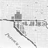 Detail from computer-generated version of Pierre Charles L'Enfant's original plan for the capital of the United States, enhanced to show Thomas Jefferson's handwritten editorial changes. Compiled in 1791 under the direction of Pres. George Washington, this plan still guides the planning of the central core of Washington, D.C. An architect and military engineer, the French born L'Enfant joined the Continental Army and spent the winter of 1777 to 1778 at Valley Forge, where he first met Washington. L'Enfant's plan was transferred to the Library of Congress by the U.S. Army Corps of Engineers in 1918 and has recently been restored by the Library's Conservation Office and sealed in a case filled with argon gas.
Complementing Harrisse is the Johann Georg Kohl Collection of 474 annotated manuscript facsimile maps relating to the discovery and exploration of the New World from 1500 to 1834. These maps were copied by the nineteenth-century German geographer Johann Georg Kohl from "old books" and collections in Germany, France, and England. The maps are listed by Justin Winsor in The Kohl Collection (now in the Library of Congress) of Maps Relating to America, with an Index by Philip Lee Phillips (Washington, 1904). Additional information about Kohl is found in John A. Wolter, "Johann Georg Kohl and America," The Map Collecto (volume 17, Tring, England, December 1981), and Hans-Albrecht Koch, Margrit B. Krewson, and John A. Wolter (ed.),Progress of Discovery: Johann Georg Kohl (Graz, Austria, 1993).
The Lowery Collection of maps was bequeathed to the Congressional Library by Woodbury Lowery on July 5, 1905 "hoping they might there be most accessible to students." A prominent Washington patent lawyer, Lowery travelled throughout Europe collecting books and maps for his avocation, a scholarly study of the cartography of early Spanish settlement in the Western Hemisphere, which was edited by Philip Lee Phillips and published under the title The Lowery Collection: A Descriptive List of Maps of the Spanish Possessions within the Present Limits of the United States, 1502 1820 (Washington, 1912).
 One of the great cartographic treasures of the Library, this explorer's chart of the northeast coast of North America from Cape Sable to Cape Cod was drawn by Samuel de Champlain in 1607. (Henry Harrisse Collection)
For the student of nineteenth-century exploration of the American West, the division has particularly rich holdings. The Lewis and Clark Collection is indispensable for understanding the early mapping of this region. Transferred in 1925 from the files of the Office of Indian Affairs, Department of the Interior, the collection consists of twelve manuscript maps associated with the planning of the Lewis and Clark overland expedition to the mouth of the Columbia River from 1803 to 1806 and activities relating to William Clark's official duties as superintendent of Indian Affairs at St. Louis from 1807 to 1813 and as governor of the Missouri Territory. A related but no less valuable item from the Vault Map Collection is Robert Frazer's large manuscript Map of the discoveries of Capt Lewis & Clark from the Rockey mountain and the River Lewis to the Cap of Disappointement or the Coloumbia River At the North Pacific Ocean A member of the Corps of Discovery, Frazer prepared this map in 1806 to accompany his own journal of the expedition, which was never published. Later, the map came into the possession of John Henry Alexander, the first Maryland state cartographer, and was obtained in 1922 by the Library from the estate of Alexander's son.
Much of the trans-Mississippi west was explored and mapped by military officers of the U.S. Army's Corps of Topographical Engineers and, after the Civil War, by civilian scientists of the Interior Department whose final reports and maps were published by Congress. Normally bound in House and Senate documents, the maps are often difficult to use because of their large format and fragile nature. Many of these maps, which are in the division's Congressional Serial Set Collection, are described and reproduced in Carl Wheat's monumental five-volume work, Mapping the Transmississippi West (San Francisco, 1957-1963). Related material is found in the Gilbert Thompson Collection.
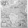 Diego Gutirrez's celebrated map of the Western Hemisphere entitled Americae sive qvartae orbis partis nova et exactissima descriptio. One of two known copies, it was engraved by the great Flemish artist Hieronymus Cock in 1562 and has the distinction of being the first map to carry the name California. At one time it was owned by the Duke of Gotha.
Three significant historical maps of vital importance to the history of the United States were made the special focus of Lawrence Martin's desiderata list during his tenure as Chief of the Geography and Map Division from 1924 to 1946. An authority on boundary problems and a consultant to the State Department, Martin collected these maps for their value in illuminating issues relating to boundary disputes. Each has been brought together as a separate collection under the names of the authors of these maps: John Mitchell, John Melish, and John Disturnell.
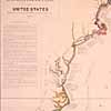 One of three original maps depicting the maritime explorations of the coasts of the United States, this historical chart of the Atlantic Coast was compiled by the German geographer Johann Georg Kohl in 1856 for the U.S. Coast Survey. The different colored lines indicate the extent of the coast visited by the various explorers. (Johann Georg Kohl Collection)
Division holdings are particularly rich sources for the study of the French and Indian War and the American Revolution. Numbering more than two thousand titles, including six hundred original manuscript drawings, they represent the work of the leading British, French, and American eighteenth-century cartographers and publishers. A list of maps covering this period was compiled by John R. Sellers and Patricia Molen Van Ee as part of the Library's American Revolution Bicentennial program under the title Maps and Charts of North America and the West Indies, 1750 1789: A Guide to the Collections in the Library of Congress (Washington, 1981). Particularly valuable for the study of military mapping during the war are the following collections: Peter Force, William Faden, Rochambeau, Richard Howe, and Pierre Ozanne. Supplementing this material are photostatic copies of the maps prepared by the surveyors-general of the Continental Army, Robert Erskine and Simeon DeWitt, obtained from the New-York Historical Society, and the Duke of Cumberland Map Collection on microfiche from the Royal Library in Windsor Castle.
A unique form of cartographic artifact during the colonial era was the powder horn map. Embellishing powder horns with maps was a popular activity with soldiers serving in British Colonial America, especially during the French and Indian War and the American Revolutionary War. The division's collection includes five horns of British origin dating from the French and Indian War era, three American ones engraved during the Revolutionary War, and one believed to have been made or carried by a Pennsylvania frontiersman some time between 1790 and 1810. Several of the horns include the names of their owners.
Manuscript maps relating to Andrew Jackson's military campaigns during the War of 1812 and postwar activities with the Creek Indians are found in the Blair Collection. These maps were originally presented to the Library in 1903 by the descendants of Francis P. Blair, Jackson's adopted son, along with his papers which are housed in the Manuscript Division. From a donation by Dr. Warren Coleman of New York City in 1936, the division acquired a manuscript map of the Battle of Horseshoe Bend which took place March 27, 1814, on the Tallapoosa River in eastern Alabama where Gen. Andrew Jackson defeated a large force of Creek Indians. This map was compiled by Dr. Coleman's ancestor, a regimental quartermaster, who drew it "upon his hat the morning after the battle."
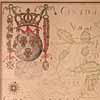 Jean-Baptiste Louis Franquelin's Carte de l'Amrique Septentrionale [left side] [right side] was originally compiled in Quebec in 1688. As the official court cartographer for the governor of New France from 1678 to 1700, Franquelin had access to the reports prepared by returning frontier missionaries and explorers. This copy was made for the Library of Congress between 1909 and 1910 from the original in Archives du Dpt des Cartes de la Marine. Franquelin's maps were never published.
The American Civil War remains one of the most active topics of research in the Geography and Map Division. Fortunately for the researcher, the Library of Congress has the finest collection of Civil War printed maps and the foremost collection of Confederate field maps, numbering more than 2,300 maps and atlases. An additional 162 maps from twenty-eight collections are found in the Library's Manuscript Division. These materials are described in Richard W. Stephenson's Civil War Maps: An Annotated List of Maps and Atlases in the Library of Congress (Washington, 1989). Included are topographic sketch maps showing the approximate terrain or routes of potential conflict, maps depicting the theater of military operations, order-of-battle maps showing the location of command units, strategic maps used in the planning and execution of campaigns, and commercial and newspaper maps designed to persuade and inform the public. The American Civil War also witnessed the introduction of reproduction techniques such as sunprints, photography, and lithography to keep up with the great demand for maps.
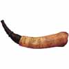
During the French and Indian War and the American Revolution, soldiers often embellished their powder horns with maps and other images. The more elaborate works are thought to have been prepared as campaign souvenirs for British officers. The St. Lawrence River and the cities of Quebec and Montreal are depicted on this powder horn.
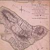 The Battle of Bunker Hill, the first major battle of the American Revolution, is depicted in this manuscript plan by an aide to the leader of the British troops, Gen. William Howe. The map was later acquired by William Faden, geographer to King George III and foremost British map publisher of the late eighteenth century. (William Faden Collection)
The finest collections of Confederate maps available today is the Jedediah Hotchkiss Collection. Acquired in 1948 from Mrs. R. E. Christian, granddaughter of Maj. Jedediah Hotchkiss, chief topographer of the Army of Northern Virginia, it consists of manuscript field sketches, reconnaissance maps, county maps, regional maps, and battle maps. The centerpiece of the collection is a large, table-size detailed drawing of the Shenandoah Valley surveyed and compiled at the request of Gen. Thomas J. "Stonewall" Jackson for his spring campaign of 1862. A computer-enhanced (digitized) version of this map has been recently reproduced by the U.S. Park Service as an aid to its management of historic sites in the Shenandoah Valley. The Confederate collection has been enhanced by photostatic copies of seventy-five unique manuscript maps from the Military Academy at West Point, the Virginia Historical Society, and the College of William and Mary. These map were prepared for Gen. Jeremy F. Gilmer, chief of the Confederate engineers. Other collections that pertain to the Civil War include William Tecumseh Sherman, Orlando M. Poe, Nathaniel Prentiss Banks, Samuel P. Heintzelman, and George B. McClellan. Also of interest are maps that belonged to Gen. Joshua Lawrence Chamberlain, whose heroism at Gettysburg has been featured by Michael Shaara in The Killer Angels (New York, 1974), a Pulitzer-Prize winning account of the four-day battle which was made into the movie Gettysburg (1993). The map collection was donated by Eleanor Wyllys Allen, Chamberlain's granddaughter. It includes maps related to Gettysburg, Petersburg, and Five Forks. A group of thirty-one maps illustrate the operations of the Armies of the Potomac and James from May 4, 1864, to April 9, 1865.
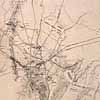 Sketch map of the battlefield of Gettysburg by Jedediah Hotchkiss, chief topographer of the Confederate Army of Northern Virginia, shows troop positions, July 1-2, 1863. Confederate divisions and corps are named, but Federal commands are not named. (Jedediah Hotchkiss Collection)
Cartographic materials that document the development and growth of urban America are extensive and unequaled. Through copyright deposits, government transfers, and exchanges, the division has acquired the nation's foremost collection of city maps issued by fire insurance companies and underwriters. Developed in London in the 1790s and first published in the United States by the Jefferson Insurance Company of New York City in the 1850s, fire insurance maps are large-scale maps designed to provide insurance underwriters with detailed information concerning fire risks for individual residential and commercial properties. They depict street patterns, water systems, lot lines, individual buildings and construction material. Their historical value is enhanced by updated editions.
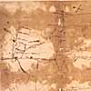 A manuscript map of the region from Lake Erie to the mouth of the Ohio River drawn about 1755 by "Chegeree (the Indian) who says he has travelled through the country."
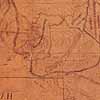 The first map to show the region that is now part of Yellowstone National Park. Drawn by Pierre-Jean DeSmet for Col. Donald D. Mitchell, Superintendent of Indian Affairs for the St. Louis Department, it was used during the 1851 Fort Laramie Treaty negotiations to show boundaries for the northern plains Indian tribes. A Belgian Jesuit missionary who had traveled through much of the Oregon country and the Great Plains establishing Catholic missions, Father DeSmet compiled a number of important maps of the region. The information for this map was furnished to DeSmet by Jim Bridger, the famous guide and fur trapper who led or directed at least seven trapping and hunting parties through the region between 1835 and 1850.
By far, the largest number of fire insurance maps is found in the Sanborn Map Company Collection which contains 600,000 sheets representing 12,000 American cities dated from 1876 to the 1970s. The bulk of these maps were deposited by the company as copyright deposits, but about one-third were transferred from the Commerce Department's Bureau of the Census in 1967, which originally purchased the maps at a cost of one-half million dollars. The Census Bureau maps contain paste-on correction sheets to reflect changes such as the construction or demolition of individual buildings. The entire collection is available on 35mm black and white microfilm from Chadwyk-Healy, Inc. and is described in Fire Insurance Maps in the Library of Congress: Plans of North American Cities and Towns Produced by the Sanborn Map Company (Washington, 1981). Other fire insurance holdings include the work of H. Bennett, the Charles E. Goad Company, Ernest Hexamer, the Minnesota and Dakota Fire Underwriters Company, Charles Rascher, and Alphonso Whipple. All of these companies were eventually absorbed by Sanborn, Inc.
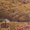 Panoramic view of Phoenix, Arizona by C. J. Dyer in 1885. Compiled from drawings by topographic artists who walked the streets, these detailed bird's-eye perspectives are one expression of the optimism of urban life during the Victorian era. (MARC Map Collection)
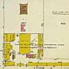 The Sanborn Map Company prepared detailed maps of some 12,000 American cities for fire insurance underwriters, including this detail from a sheet showing the Douglas Fairbanks Pictures Corporation Studio in Los Angeles as it appeared in 1919. These maps are color-coded to depict building materials. (Sanborn Map Collection)
The Geography and Map Division has extensive holdings of panoramic maps of North American cities and towns. Also known as bird's-eye views, perspective maps, or panoramic views, these maps provide unique images of cities as viewed at an oblique angle from an elevation of 2,000 to 3,000 feet. Prepared by artist-cartographers who walked the streets sketching buildings and major landscape features, they were used to promote a city's commercial and residential potential. Although the division has more than 1,800 panoramic views, they continue to be acquired. Dating from 1837 to the 1920s, panoramic views depict a wide variety of urban features such as streets, hotels, houses, mills and factories, court houses, schools and colleges, railway depots and round-houses, fair grounds, cemeteries, canals, bridges, gas works, ferries, race courses, lumber yards, hospitals, banks, and churches. Many include insets of architectural renderings of private homes, commercial and public establishments, and industrial plants. Two special collections particularly rich for the study of small town America during the Victorian Age are those of Albert Ruger, a Prussian immigrant who began drawing views while serving with the Ohio Volunteers during the Civil War, and Thaddeus Mortimer Fowler whose career spanned almost the entire era, from 1870 to 1922. The division has 224 of the 301 separate views attributed to Fowler, covering eighteen states and Canada. More than one hundred views were presented to the division from 1970 to 1971 by the artist's daughter-in-law, Mrs. T. B. Fowler, and her family. Other cartographic-artists and panoramic publishers represented in the collections are Oakley H. Bailey, Lucien R. Burleigh, Augustus Koch, and Henry Wellge. A checklist of the Geography and Map Division's holdings is found in Panoramic Maps of Cities in the United States and Canada, compiled by John R. Hbert and revised by Patrick E. Dempsey (Washington, 1984).
While the Geography and Map Division's special collections focus primarily on North America, coverage is worldwide. Particularly noteworthy is a small but representative collection of large seventeenth-century decorative wall maps of the world that were produced by leading Dutch, French, and Italian publishing houses to meet the growing demand for attractive wall hangings by an emerging middle class. Due to their size, few wall maps have survived the ravages of time. Of the 125 recorded copies, the division has eighteen. Beginning in 1608, the Dutch cartographer Willem Janszoon Blaeu first published a set of separate wall maps of the four continents. Through the generosity of Hans P. Kraus, the division has copies of African, Asian, and European maps reprinted by the Visscher firm about 1657. The Kraus gift also included a rare set of four continental maps and a map of the world published by the Joachim Ottens publishing house in Amsterdam dedicated to William and Mary, who reigned from 1689 to 1702. Only one other set of these five maps preserved together is known. In addition, the wall map collection includes a set of Blaeu's 1608 four continental maps reissued in Bologna in 1673 by Pietro Todeschi, a noted engraver of perspective views; an unrecorded French edition of Blaeu's wall map of Africa, published by Hubert Jaillot in 1669; and a reengraving in Italy by Guiseppe Longhi and Carlo Scotti about 1680 of the first edition of Frederik de Wit's giant wall map of the world, originally published in Amsterdam in 1660.
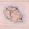 Thismap of Runion Island in the Indian Ocean is one of forty manuscript maps and views of volcanoes drawn by the nineteenth-century German geographer Carl Ritter and collected by Franz Ritter von Hauslab, an Austro-Hungarian military officer, cartographer, and ardent map collector. (Hauslab-Liechtenstein Map Collection)
Maps and charts of Latin and South America are well represented. The oldest and most remarkable is a land litigation map of Oztoticpac, a royal Aztec estate in the city of Texcoco near present-day Mexico City. This map has been analyzed by Howard F. Cline in A la Carte. Other milestones of Spanish colonial cartography in Latin America include Juan de la Cruz Cano's rare Mapa geogrfico de America meridional (Madrid, 1775), an eight-sheet wall map whose sale was suppressed by Spanish authorities shortly after publication; William Faden's facsimile of the 1775 Cruz Cano map published in 1799 in London at the request of Thomas Jefferson; and Nicolas de Lafora's manuscript copy of Mapa de toda la frontera de los dominios del rey en la America septentrional, originally compiled in 1771 to show Mexico's northern frontier. Another manuscript version of Lafora's map is part of the Gen. Peter H. Hagner Collection.
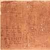 Land litigation map of Oztoticpac, a royal Aztec estate in the city of Texcoco near present-day Mexico City. Hand-drawn by one or more Aztec Indians in 1540, it was prepared to show the lands and properties of Don Carlos Chichimecatecotl, a converted Texcocan noble executed in 1539 by Spanish officials during the Inquisition for retaining Aztec spiritual relics. Although primarily a pictorial document, it is annotated in Spanish and Nahuatl, the Aztec language.
Special collections that relate primarily to Latin and South America were assembled by John Barrett, director of the Pan American Union, 1894 to 1920; the Panama Canal Zone Library-Museum; the Portuguese-Spanish Boundary Commission, described in Lawrence Martin and Walter W. Ristow's "South American Historical Maps" in A la Carte; the Maggs Collection of early Spanish nautical charts; and Ephraim George Squier, an American journalist engaged in diplomatic and archeologic work in Central America and Peru from 1849 to 1865. The maps prepared by Squier are described by John R. Hbert in the Quarterly Journal of the Library of Congress (volume 29, Washington, January 1972).
One of the prized additions to the division is the Hauslab-Liechtenstein Map Collection which includes some eight thousand manuscript and printed maps primarily related to Europe with special emphasis on the Austro-Hungarian Empire and its separate provinces. Assembled by Franz Ritter von Hauslab, a member of the Austrian nobility and a distinguished military engineer who fought with Russian forces against Napoleon Bonaparte's armies, the collection reflects his life-long interests in military affairs, the application of lithography to map printing, the portrayal of terrain on maps, and thematic mapping. The major categories include maps of European cities; military fortification plans; battle maps depicting most of the major European conflicts of the seventeenth through the nineteenth centuries; medium- and large-scale topographic map series; maps and views of volcanoes; panoramic and perspective maps; geologic and geognostic maps; language and ethnographic maps; and facsimiles and tracings which illustrate the history of cartography. The nineteenth century was a time for testing new printing technologies, all of which are represented. These include examples of wood-block printing, copperplate engraving, lithography, chromolithography, photolithography, zincography, heliogravure, sun prints, and transfers. In addition, the collection includes a number of manuscript maps and views of Italy prepared by Carl Ritter, a leading nineteenth-century German geographer, whose library was purchased by Hauslab in 1861.
While the majority of the division's maps relating to World War I and World War II are found among the division's general collections, several special collections contain pertinent material, such as that of World War I Gen. Charles Pelot Summerall, commander of the 4th, 5th, and 9th Army Corps in France; the Nazi geographer Karl Haushofer; and Albert Speer, Hitler's armaments minister and personal architect.
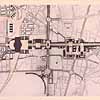 One of twenty-five hand-colored photographic plans for the rebuilding of Berlin prepared by Albert Speer, Adolph Hitler's architect, during the 1930s. (Albert Speer Collection)
Although the coastal outline of Africa was one of the first continents charted by European cartographers, the mapping of that continent's interior did not begin in earnest until after World War II. The only collection related specifically to Africa comprises maps acquired with the records of the American Colonization Society, an organization that assisted Black Americans in settling in Liberia during the nineteenth century. For further information on this collection and other cartographic material relating to African Americans, see Debra Newman Ham (editor), The African-American Mosaic: A Library of Congress Resource Guide for the Study of Black History and Culture (Washington, 1993).
The student of East Asia will find the division's collection of maps of China, Korea, and Japan one of the most extensive outside of Asia. They are valuable not only for their geographical and historical insight but also because they provide students of cartography, culture, and art with artifacts that reflect a nontraditional Western European geographic mode of visual expression. Early Chinese, Korean, and Japanese maps differ from the Western European tradition in terms of the use of symbols and color, degree of pictorialization, and media and format. In an insightful article (Asian Art, New York, Fall 1992) based on the division's collection, the cartographic historian Cordell D. K. Yee demonstrates that the main difference between Asian and European cartography relates to the central role that art, particularly poetry, calligraphy, and landscape painting played in the development of Chinese cartography until the end of the nineteenth century.
The largest collection of rare Chinese maps was acquired through the fforts of Arthur W. Hummel, distinguished sinologist and head of the Library's Orientalia Division from 1928 to 1954, and the generosity of Andrew W. Mellon. Among the cartographic treasures are an annotated wood-block folded atlas of China from the Ming Dynasty entitled "Looking At Distant Places as if They Were on the Palm of Your Hand"; a seventeenth-century silk scroll depicting in the form of landscape paintings four important frontier regions of the Manchu dynasty, including one illustrating a clash between Russian and Manchurian troops on the Heilungkian or Amur River; and a rare wall map of the world by the Jesuit missionary Ferdinand Verbiest, engraved on eight scrolls in Peking in 1674.
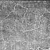 A rubbing taken from a 4,000-year-old stone tablet in Sian, the ancient capital of China, represents one of the oldest extant maps. Made in 1935 by Prof. W. B. Pettus of the College of Chinese Studies at Peking and given to the Library by George B. Cressey, Professor of Geography, Syracuse University, the map was apparently prepared for pedagogical purposes. It delineates the provinces of China which paid tribute to Emperor Yu, the founder in 2205 b.c. of the first legendary dynasty.
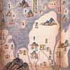 Detail of manuscript Chinese map, "Ten-Thousand-Mile Map of Maritime Defenses," drawn during the Qing Dynasty, ca. 1705. This map, which is one of eleven maps mounted in an accordion-folded album fifty-one feet in length, shows military defenses along the Chinese coast from Hainan Island to the Shandong Peninsula. (Arthur W. Hummel Collection)
Korean cartography was directly influenced by Chinese cartographic traditions that reached the peninsula during the Koryo dynasty (918 1392). The bulk of the Library's collection of rare Korean maps and atlases were acquired by two eminent educators, the archaeologist Langdon Warner, leader of the first and second China expeditions of the Fogg Museum of Harvard University, and the geographer Shannon McCune, born in Korea of American missionary parents. These collections include both manuscript copies and woodblock impressions, which generally are rarer and more valuable than manuscript copies. The division's Korean atlases range in date from circa 1760 to 1896 and are representative of the traditional hand atlases produced since early in the Yi Dynasty (1392 1910).
A number of very early rare manuscript and printed Japanese scroll maps are available for examination including one depicting the 1614 fortifications of Osaka Castle. A world map by the Japanese Buddhist scholar-priest Hotan provides an image of the Buddhist vision of world geography in terms of its cosmology. Entitled Nansenbushu Bankoku Shoka no Zu [Map of the Universe], it displays India, where Buddha was born, and China as the center of the world. Printed from woodcuts in 1710, this prototype map was popular in Japan until the midnineteenth century.
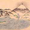 Detail of Japanese manuscript scroll map (35 by 939 cm.) showing the Tokaido, the main land-sea route from Edo (Tokyo) to Nagasaki, with Fujiyama in the background. Kyoho period (1716- 1736).
Most of the division's rare maps by Japanese mapmakers, however, date from the nineteenth century. A teaching collection of eleven maps assembled by Shannon McCune for use in a series of lectures he gave on Japanese geography include wood-block maps of the world, Japan, and administrative districts, one in the form of a scroll. A large-scale manuscript map of Japan shows coast lines, major rivers, roads, and terrain for the period 1816 to 1818. Drawn by Ino Tadataka, it consists of 214 sheets, with water color wash on rice paper.
Maps of Southeast Asia are found in the Minto Collection, including manuscript maps of Java, Malaccas, and Sumatra drawn by British Army engineers about 1811, just before the British invasion and annexation of Java. This collection is described by John A. Wolter in the Washington Map Society Portolan of April 1986. Additional maps of Southeast Asia are found in the John Barrett Collection.
While the great majority of cartographic materials housed in the Geography and Map Division are useful primarily for the information they convey about geographic place or phenomena associated with place, certain collections are also valuable for the study of the cartographic process itself. For the study of nineteenth-century map design and printing, the collections of Hauslab-Liechtenstein, Charles Rau, and Mylon Merriam are major sources of primary materials.
One of the notable contributions of American cartography was the development of the physiographic diagram or landform map. Relevant collections are those of the noted geomorphologist and teacher William Morris Davis, whose work with the block diagram technique laid the foundation for this form of cartography; Guy-Harold Smith; Erwin Raisz; Richard Edes Harrison, who began his career in journalistic cartography as a member of the staff of Fortune magazine in the 1930s where he developed innovative and distinctive perspective maps and landform maps that provided a generation of World War II readers with an image of the earth; Hal Shelton, whose work is found in the H. M. Gousha Collection; and Theodore R. Miller.
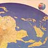 Manuscript map of Japan as viewed from Burma during World War II. This unique perspective is one of four different views drawn by Richard Edes Harrison for the December 1943 issue of Fortune. (Richard Edes Harrison Collection)
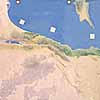 Palestine as portrayed by cartographer-artist Hal Shelton, illustrating his unique technique for depicting landforms. Starting with an offset blue-line lithographic image of a contour map etched on a zinc printing plate, the map image was then painted with acrylic paints using an oscillating-needle airbrush. Originally designed for use by airline passengers, Shelton's maps were widely adopted for aeronautical charts and educational purposes.(The H. M. Gousha Company Collection)
An excellent primary source for the study of map design in North America is a collection of competition drawings submitted to the annual American Congress on Surveying and Mapping (ACSM) Map Design Competition. Open to all map makers in the United States and Canada, the competition is sponsored by ACSM to promote concern for map design and to recognize significant design advances in cartography. Entries are judged on the basis of achievement of stated design objectives, typography, color, and craftsmanship. After winning entries are exhibited at the annual ACSM national convention, they are transferred to the Geography and Map Division for addition to the permanent map collections of the Library of Congress.
While examples of map printing artifacts are scarce, and seldom found in collections because of their vulnerability or value, the division has acquired representative examples of copper engraving plates, lithographic stones, and woodblocks in order to document the development of map printing. These are filed in the Printing Technology Collection. The scribing technique is illustrated by the recently acquired American Automobile Association Collection, which contains sixty-four printing plates for the AAA road map of Maryland, Virginia, the District of Columbia, and Delaware.
Throughout history, maps have been drawn or printed on a variety of surfaces including paper, stone, metal, wood, skin, horn, and cloth. With the development of the printing press in the midfifteenth century, however, paper became and has remained the dominant printing medium. Because of the attractiveness and durability of cloth, however, maps have been published on this material since the eighteenth century as souvenirs, as travelers' aids, and for military purposes. The Cloth Map Collection includes numerous specimens of maps printed on cloth dating from the 1790s. The earliest is a "bandanna" map depicting the plan for Washington, D.C., dated about 1793. Another fascinating early cloth map depicts the decisive battle of Waterloo, Belgium, fought June 18, 1815; it was issued shortly after the battle to commemorate the victory of the Duke of Wellington over Napoleon Bonaparte.
The largest collection of cloth maps was acquired in 1983 from the British Ministry of Defense's Mapping and Charting Establishment through the assistance of Ian Mumford, then the British Liaison Officer assigned to the U.S. Defense Mapping Agency. It consists of some sixty escape and evasion maps and air-sea rescue charts produced during World War II under the direction of the British War Office's Secret Intelligence Service, M19 for both the European and Far East theaters. This section was established on December 23, 1939, to aid in the escape and safe return to the United Kingdom of prisoners of war and men lost as sea. A set of almost fifty U.S. Army Air Force "Bailout" or "Survival Maps," issued by the Army Map Service, primarily for the Far East, are also on file. A third example of World War II cloth maps is a set of bombing target maps of cities and ports in England issued by the German General Staff, June to October 1941.
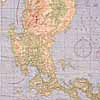 An example of the U.S. Army Air Force's "survival" maps (printed on cloth.) This map of Luzon Island in the Philippines was issued by the Aeronautical Chart Service in April 1944. Despite the large number of cloth maps printed by British, American, and German service units during the war, very few examples of World War II cloth maps are preserved in American libraries.
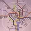 One of thirty-three translucent maps donated to the Library by the Washington Metropolitan Area Transit Authority of Washington, D.C., in 1991, it was designed to be housed in illuminated display cases in subway-station mezzanines. (Washington Metropolitan Area Transit Authority Maps)
Source: Library of Congress: The geography and map division maintains more than one hundred individual collections that have been acquired through gifts, government transfers, and purchases or assembled by division specialists according to common themes. In addition, the Vault Map Collection includes some three thousand manuscript and rare printed maps that have been filed together for their intrinsic, specially designed vault equipped with temperature and humidity controls.
